Driving Business in Northwest Alberta
A solid infrastructure network already exists in Northwest Alberta, making for easy access via road, rail and air. Competitively-priced utility services and one of Alberta’s largest rivers flowing through the region makes this a great place to start or expand your business.


Road, Rail & Air
Highways and Trucking
Primary Highway Access:
- Provincial Highway 35 – north-south
- Highway 88 – north-south
- Highway 58 – east-west
Secondary Highway Access:
- Highway 88 connector
- Highway 697 – connects: Paddle Prairie, La Crete and Fort Vermilion
Well Developed Import and Export Routes:
- Highway 2 – north-south trade corridor to southern Alberta and the United States
- Highway 16 – northwest corridor to British Columbia seaports: Kitimat, Stewart, Prince Rupert
Small and mid-size transport and trucking companies within the region and communities throughout northern Alberta service the region and provide regional, inter-provincial and international transport.
Railway
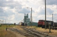
Mackenzie Northern Railway Line (CN):
- Hay River, NWT through High Level, Peace River and Grimshaw, AB
- Connects to Canadian National line at Smith, AB
Freight Service available from High Level to Hay River:
- Three times per week during peak shipping season
- Once a week during the off-season
Air Service
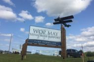
Airports that offer passenger, charter, and air cargo service:
- High Level
- Rainbow Lake
- La Crete
- Zama
- Fort Vermilion
Regional Carriers that offer regularly scheduled flights to locations in Alberta including Edmonton, Calgary, Peace River, and Grande Prairie:
- High Level
- Rainbow Lake
Helicopter and fixed wing aircraft operators also provide charter services within the region and throughout northern Alberta.
Commercial Ports
Overland and air cargo access to BC ports:
- Vancouver *
- Prince Rupert
- Stewart
- Kitimat
*Canada’s largest seaport and the main gateway for shipping to the Pacific Rim.
 Proposed 7,000 km resource corridor would improve life in Canada's North. The idea behind the Northern Corridor concept is to establish a multi-modal right-of-way stretching across the Canadian territories of Yukon, Northwest Territories, and Nunavut, as well as the northern portions of several provinces, including the REDI region of Alberta.
REPORTS
Comprehensive data and information on our agricultural industry.
REDI PILLARS
See what the REDI Region has to offer:


